Over the last few decades, Sydneysiders have been repeatedly promised urban renewal of the city’s very own ‘varicose vein’ – Parramatta Rd.
The idea, at least on paper, was to turn rundown car yards and decayed and empty shops and industrial facilities into a thriving urban boulevarde, connected to high frequency public transport.
For a long time, it felt as though this outcome would never happen and would become another one of Sydney’s great unrealised urban dreams, such as burying the Cahill Expressway, demolishing Blues Point Tower or building a high-speed rail line to Newcastle.
However, it does look as though something is finally happening with Parramatta Rd – it’s just that what is being proposed does look in parts rather odd and is worthy of close scrutiny and attention.
On 29 March, Inner West Council staff published plans showing proposed new planning controls in three Parramatta Rd precincts – Kings Bay, Taverner’s Hill and Leichhardt.
These plans were reviewed at a meeting of the council’s non-elected Local Planning Panel, and are now expected to go to the elected council in May.
Here’s my take on some of the key issues when it comes to the plans for the Taverner’s Hill precinct. I’ll hopefully get to an analysis of the other precincts in coming weeks.
About the Taverner’s Hill precinct
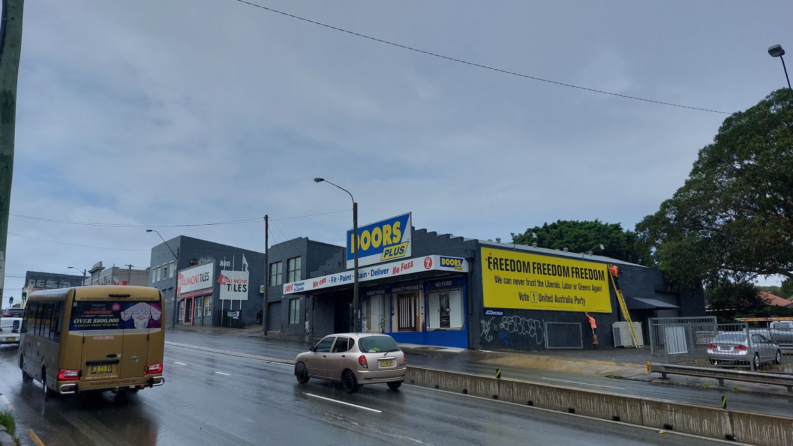
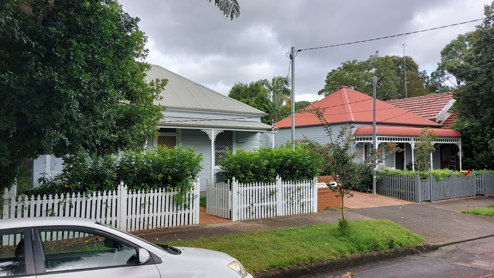
This is a precinct which covers the suburbs of Lewisham and Leichhardt and is largely made up of industrial and retail areas directly fronting Parramatta Rd, and single cottages in residential streets behind Parramatta Rd, around the Taverner’s Hill light rail stop.
In creating these plans, the council staff were guided by the NSW Government’s endorsed strategy for revitalisation of the Parramatta Road Corridor, published all the way back in 2016.
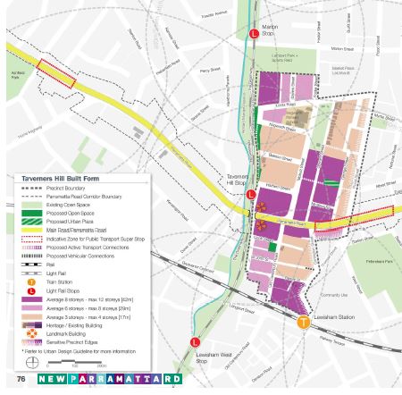
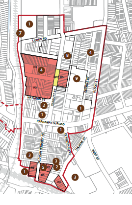
The 2016 strategy proposed that many blocks of the area around this light rail station, including blocks currently containing industrial and commercial areas and historic homes, be rezoned for redevelopment of up to eight storeys in height, as the map below shows.
It sought to take advantage of a forecast reduction in Parramatta Rd surface traffic brought about through the underground WestConnex project.
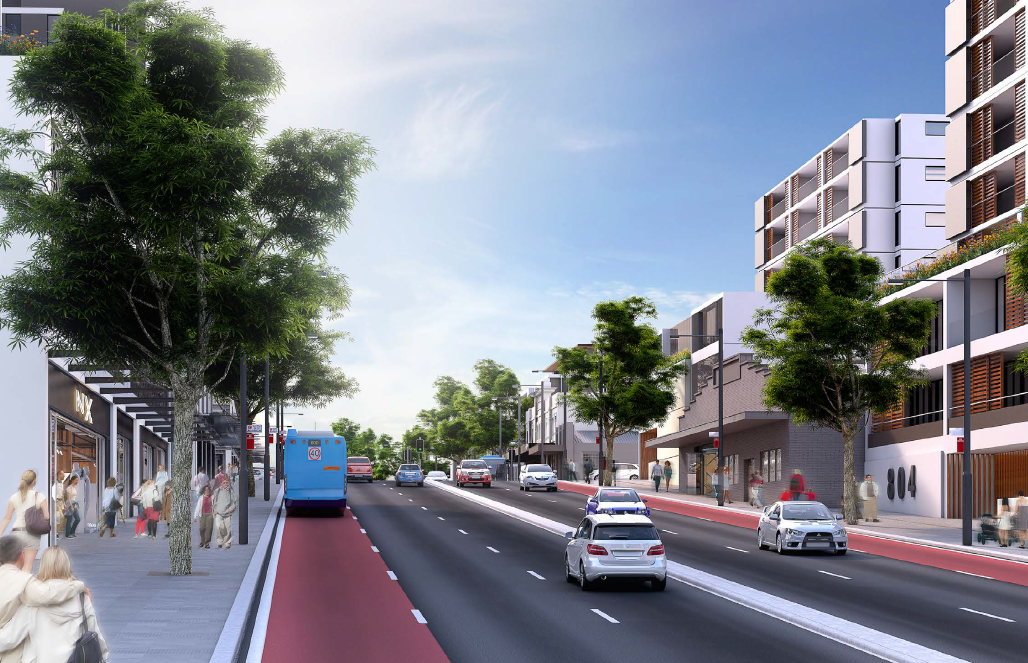
This strategy also illustrated how Parramatta Rd, in the area around the Lewisham Hotel, was meant to look post-renewal.
The council’s plans don’t promote nearly the same level of development and instead focus on a few select blocks for renewal, including along Barker, Thomas St and Old Canterbury Rd in Lewisham and Tebbutt, Beeson, Hathern and Kegworth Sts in Leichhardt.
Irrespective of the reduced impact, however, there are unusual aspects to the council’s approach, as outlined below.
The plans don’t actually renew Parramatta Rd but instead target residential areas
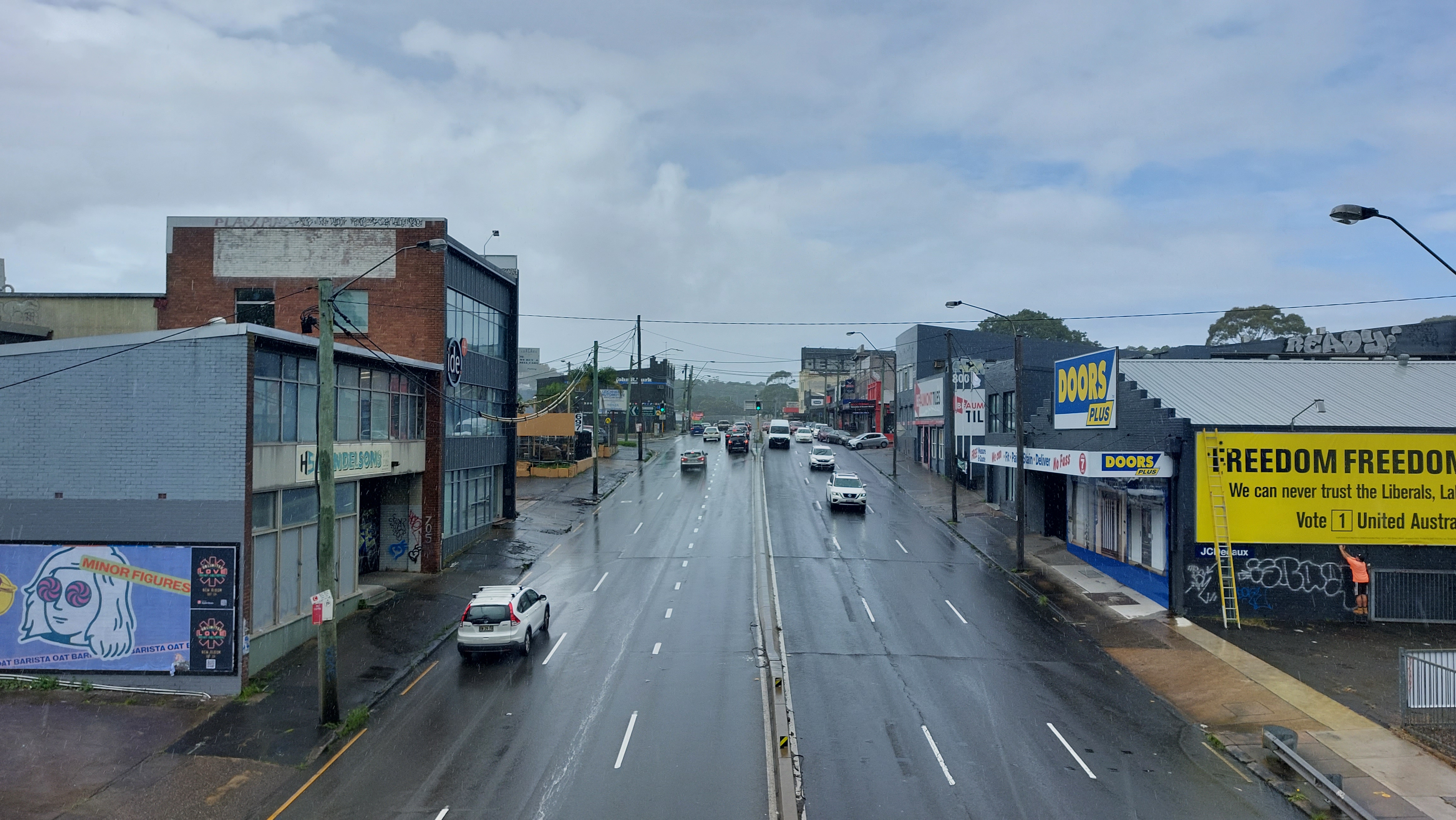
The first surprise is that the plans as released by the council are inconsistent with the NSW Government’s strategy, in that they don’t touch any of the actual land on Parramatta Rd.
This means that the plans will not deliver the glossy artist’s impression for Parramatta Rd released as part of the NSW Government’s strategy, and therefore – for the foreseeable future – the road’s urban condition will continue to divide Sydneysiders.
This appears to be because the council is maintaining its hard-line stance against rezoning industrial and employment lands, which would be required to deliver renewal along Parramatta Rd itself.
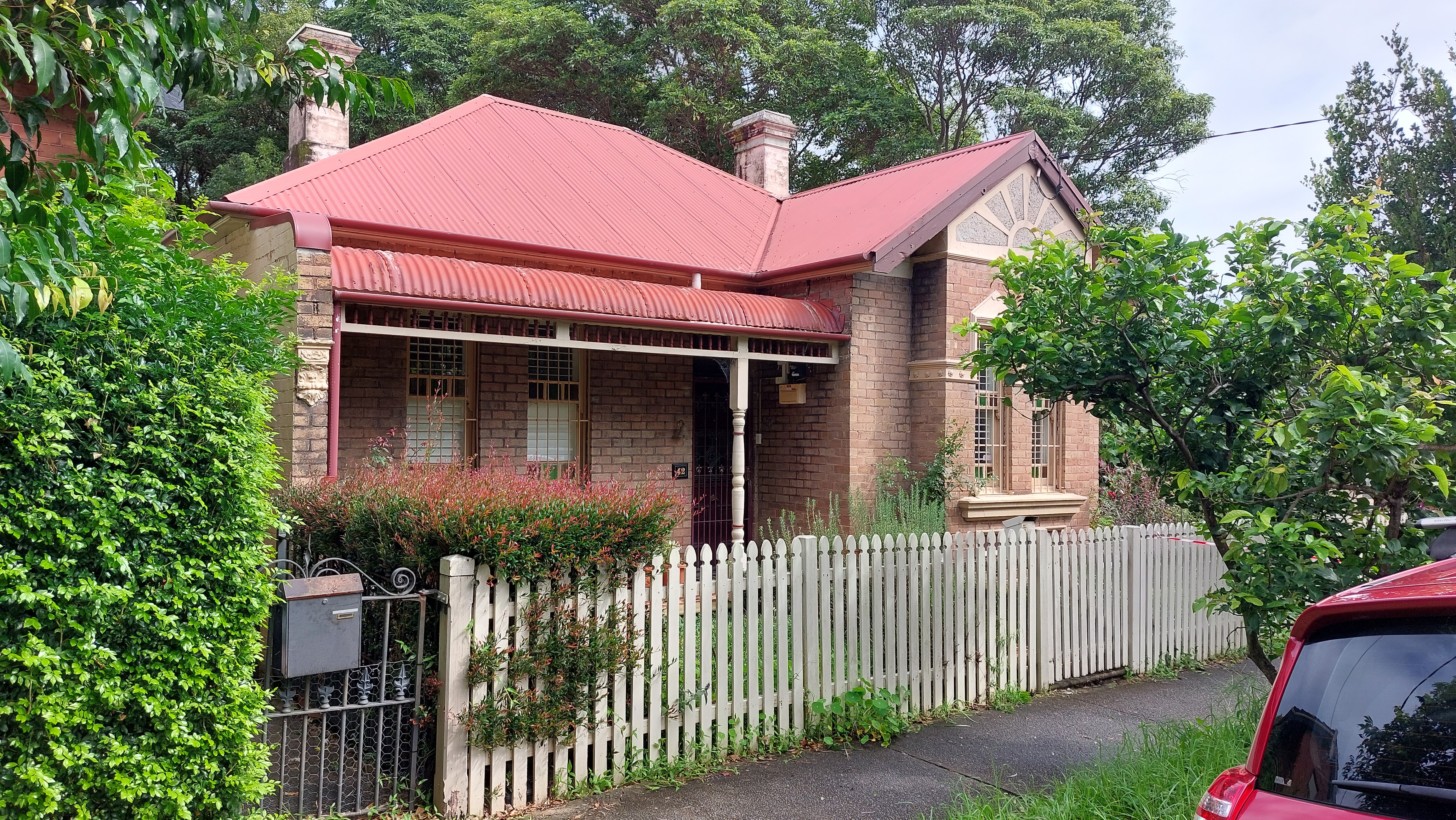
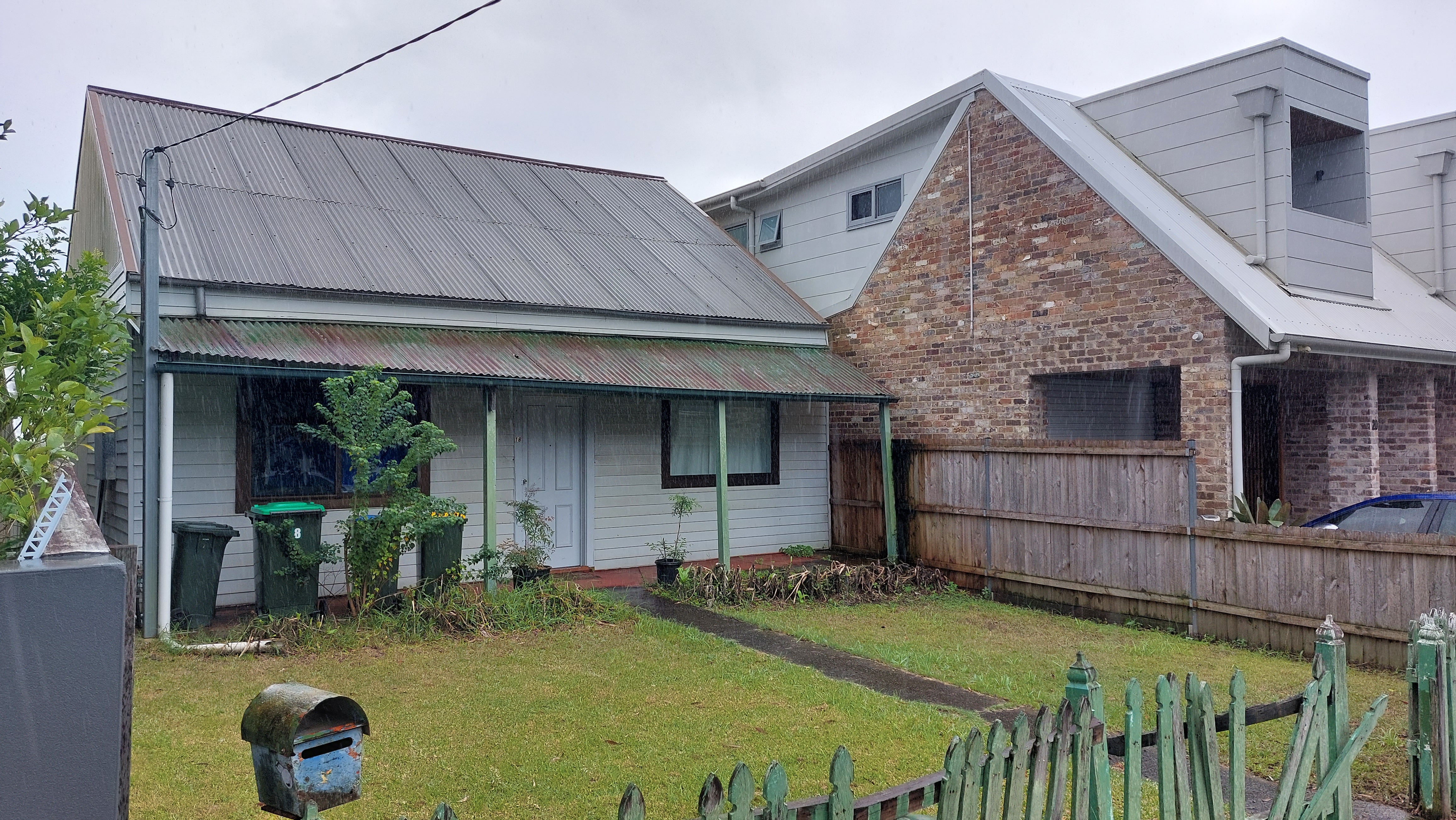
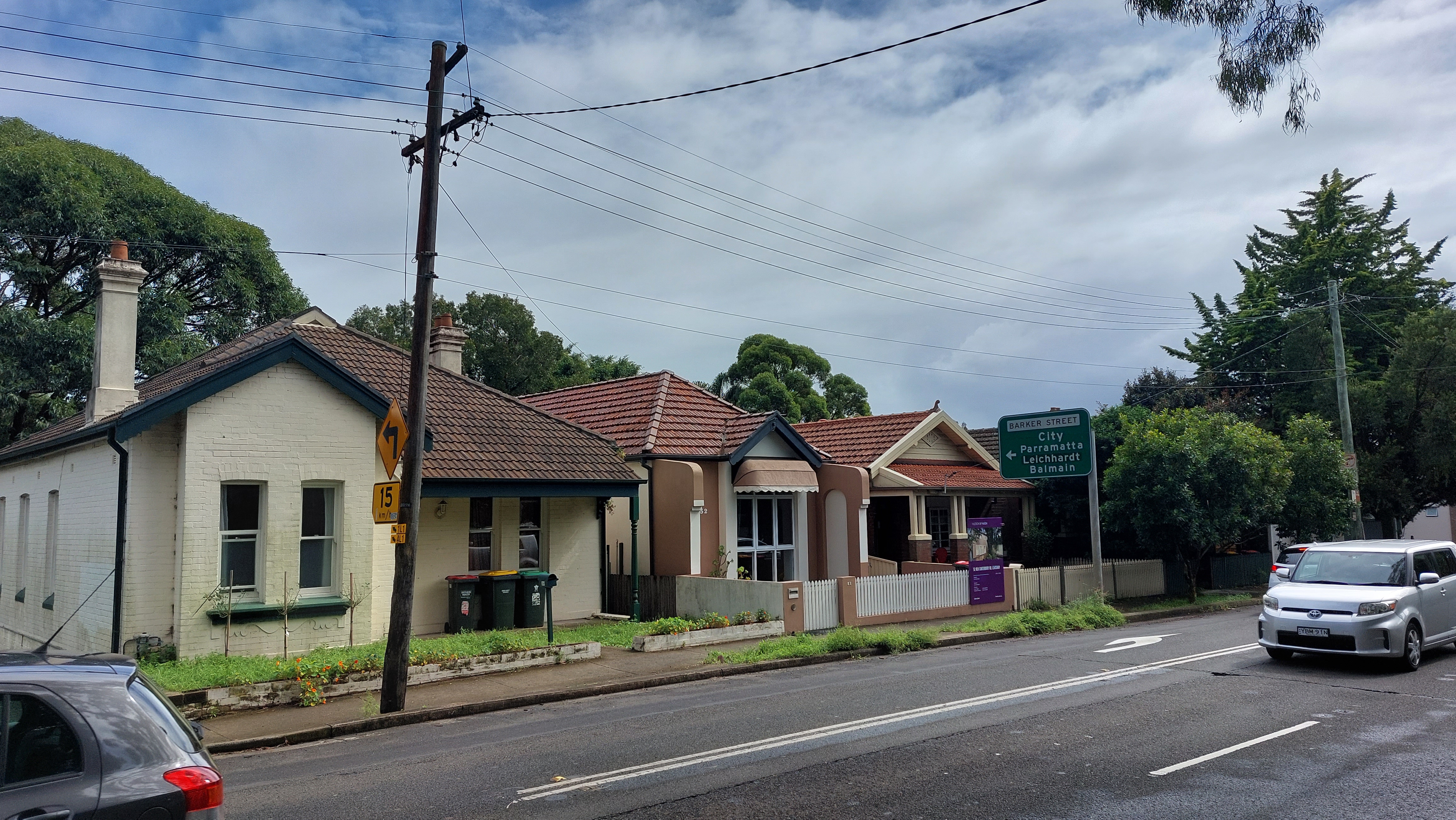
Instead, the council is focussing on rezoning existing historic residential streets and houses, including weatherboard and Federation homes, for redevelopment.
For instance, a block bounded by Kegworth, Tebbutt and Beeson St at Leichhardt is proposed for 12m high buildings (around three storeys).
A block bounded by Beeson, Tebbutt and Hathern St is proposed for 15m high buildings (four storeys), while a section of Tebbutt St is proposed for 21m high buildings (six storeys).
This illustrates the inherent difficulty in implementing the council’s draft Community Strategic Plan priority to “protect suburban streets” and to retain and enhance “the unique character and heritage of neighbourhoods” while at the same time to “protect employment lands.”
Putting a planning fence around all employment lands – even if these lands have been earmarked for renewal for many years – inevitably results in more pressure to rezone residential areas, which the council also professes it wants to protect. The Inner West community has the opportunity to decide what it prefers.
Crowded heritage houses
The plan’s approach to heritage protection is also worthy of scrutiny.
At two locations at Lewisham, the council’s planning controls make the worthy suggestion of suggesting new heritage areas and items.
This includes eight brick and weatherboard homes in Barker St, which are said to be “double-fronted cottages, of the kind typically occupied by working-class people in industrial areas such as Balmain”.
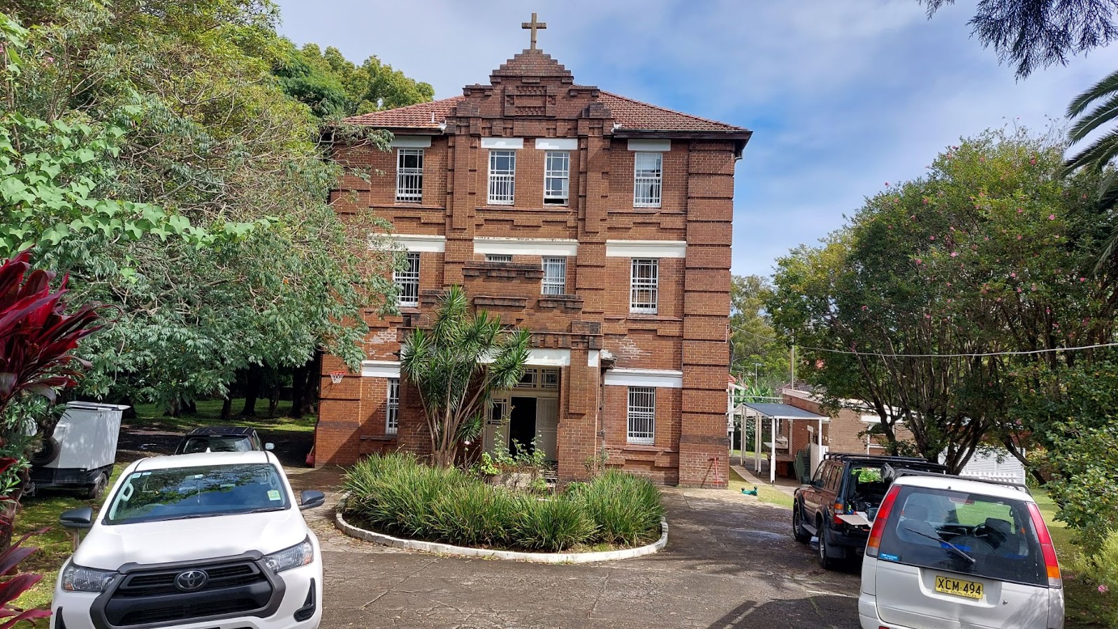
There is also a proposal to list a 1920s former convent, which is now a residence, at Thomas St.
The problem is that the plans also seek to permit proposed new developments either next to, or around, these new heritage items and areas. This is illustrated in the diagram below, from one of the consultant reports supporting the rezonings.
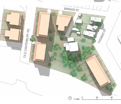
This means that owners of these properties will not be able to redevelop their properties, but then suffer the impact of new development around them.
Increased density in streets heavily impacted by traffic and noise
The plans propose increased density and height controls to permit apartment buildings up to five-six storeys in an area of Old Canterbury Rd, near the corner of Barker St, which is currently occupied by low density homes.
The council planners argue this is because this area is close to Lewisham railway station.
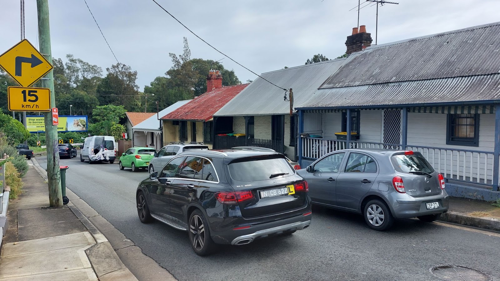
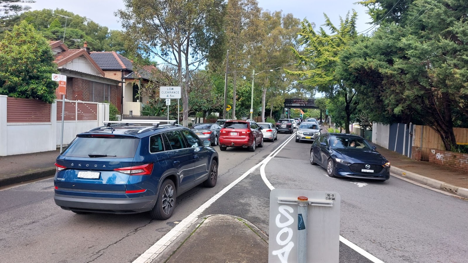
However, it also needs to be considered that this part of Lewisham – despite its old-school narrow thoroughfares – is also over-whelmed by traffic.
Barker St, for instance, is a narrow single lane road, but has been converted into a one-way thoroughfare to accommodate traffic swooping off Old Canterbury Rd and towards the bridge over Parramatta Rd.
The high volume and speed of traffic means that, at times, it can takes minutes to simply cross from one side to the other of Barker St, even though it’s only a single lane road.
In short, you feel you are taking your life in your hands when you walk around this area.
The same area is also heavily impacted by noise from the main Western railway line.
It’s questionable whether increased density should be contemplated at this location.
It’s also difficult to even understand how builders will be able to get access for the construction process.
The plans may be at odds with a mapped biodiversity corridor
The Lewisham section of the Taverner’s Hill rezoning plans is in a mapped terrestrial biodiversity corridor.
This corridor was created as part of the former Marrickville Council local environment plan in 2010, largely to help protect the endangered long-nosed bandicoot and to protect the Iron Cove to Cooks River Greenway vision.
A 2010 study found that bandicoots live in the underfloor areas of historic houses and in nearby natural foraging habitat, including in backyards.
Unfortunately, a more recent study by the University of Sydney has reportedly found no evidence of a current Inner-West bandicoot population.
However, it should be noted that the colony does currently remain listed and that this is not the first time the colony has disappeared from public view – only to return at a later time.
Bandicoots had regularly been seen in the Greenway corridor up until the 1960s, before disappearing and then re-emerging in 2002. This gives some hope that the colony will return to the corridor, if the right framework is in place.
The existing council biodiversity development control plan (DCP) requires a proposed development to complete a “test of significance” if it disturbs more than 25 per cent of a site, including the underfloor area of a historic home.
This is why some people building new granny flats in the Greenway corridor have been required to put them on piers, to provide ongoing habitat for the bandicoots.
The council’s planning proposal says the Parramatta Rd plans are consistent with the existing mapped biodiversity area and planning provisions, and suggests a future DCP will deal with this issue.
However, it is hard to see how this is the case, when the plans will expressly lead to the demolition and redevelopment of old homes with underfloor areas, and more than likely reduce the area of foraging habitat. It’s also hoped a future DCP will not undermine existing protections.
Parking impacts
The proposal includes new maximum parking rates, which will see studio apartments banned from having any allocated parking spots, and only one in three one-bedroom apartments having a parking spot.
In addition, only seven out of ten two-bedroom apartments will be allowed to have a parking spot.
In addition, in an experimental new approach, this parking will be required to be ‘unbundled’ from the apartments themselves, which means the parking spot will not be on the same strata title as the apartment itself and will be bought separately by buyers.
These carparking spots could also be ‘decoupled’, which means they will in a location separate to where the apartment project is located.
These measures are more than likely to lead to increased demand – by new residents – for on-street parking spots, impacting existing residents. However, the plans provide no insight into how these likely impacts will be managed.
The ‘unbundled’ and ‘decoupled’ measures also seem to bring very complex legal issues, particularly in relation to how parking spots are bought and sold in the future, and how future body corporates will manage them.
The plans may never come to light
There is absolutely no guarantee any of the rezonings may lead to development, given that the council’s planning proposal requires a commitment from NSW Government to introduce an on-street rapid transit system along Parramatta Road, before any redevelopment takes place.
Given there has been no such commitment to date from the government, the whole planning scheme may never see the light of day. Inner West and Canada Bay councils have previously advocated for trackless trams on the road.
Conclusion
The community should closely scrutinise these plans, if the elected Inner West Council votes in May to submit them to the Department of Planning and Environment for a gateway certificate (which would mean the plans would be formally exhibited).
Discover more from Changing Sydney
Subscribe to get the latest posts sent to your email.

Sydney’s population is decreasing, so why increase the density?
Roads are full.
Get some recent figures, not ones up to 8 years old.
This is happening everywhere, predicted shortfall in Parramatta 100,000.