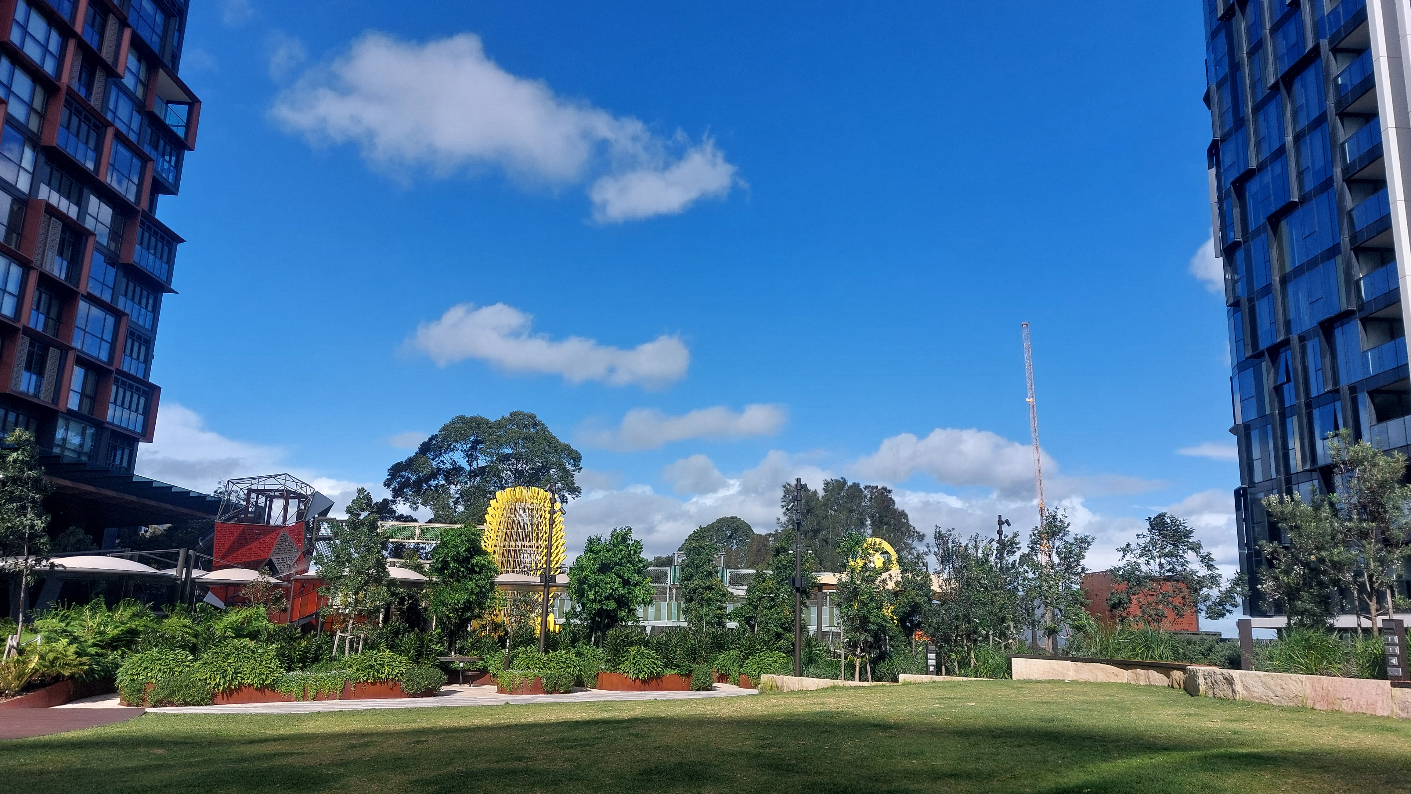
It’s a wet and cold winter’s Sydney day, but a group of children are happy to clamber through the elevated secret walkways and portholes in the banksia-themed play equipment at Wadanggari Park at St Leonards.
While the play equipment is extensive, modern and spectacular, this is not why Wadanggari Park is something special.
The reason why Wadanggari Park is special is because, not so long ago, the space in which it was located was simply fresh air sitting above the North Shore railway corridor.
Wadanggari Park is also special because it is now inspiring the re-purposing of rail corridors in other parts of Sydney, to either help cater for growth, or the impacts of that growth.
So let’s have a look at how Wadanggari Park happened, and where it could be replicated.
About Wadanggari Park
In September last year, Lane Cove Council and the NSW Government opened Wadanggari Park, at St Leonards. This $40.8m, 4,750 sq/m park is located on a bridge built over the southern entrance to St Leonards station.

Offering 180-degree views to the city, the new park offers three storeys of challenging climbing equipment, slippery dips for older children and a special young children’s zone, as well as extensive covered seating, intriguing paths, a stage, and grassy lawns.
It even has a seat specifically for train spotters.
According to a Lane Cove Council report, the concept of a public open space park – constructed on a bridge over the rail corridor – was first conceived in a 2006 strategy to plan for St Leonards by Lane Cove, North Sydney and Willoughby Councils.
While progress in gaining NSW Government support was slow, Lane Cove Council eventually obtained permission to construct the bridge to accommodate the park in late 2020 and construction began at the end of 2021.
To fund the park, the council entered into four Voluntary Planning Agreements (VPAs) with developers of surrounding sites, three of which involved cash payments and one of which involved a land dedication. The cash value of these VPAs was $46m.
In addition, the council was successful in obtaining grant funding of $4.75M under the NSW Government’s Public Spaces Legacy Program.
Lane Cove Council has access to the airspace over the rail corridor via a lease from the NSW Government for $1.00 per annum for a period of 67 years, expiring 30 May 2088.
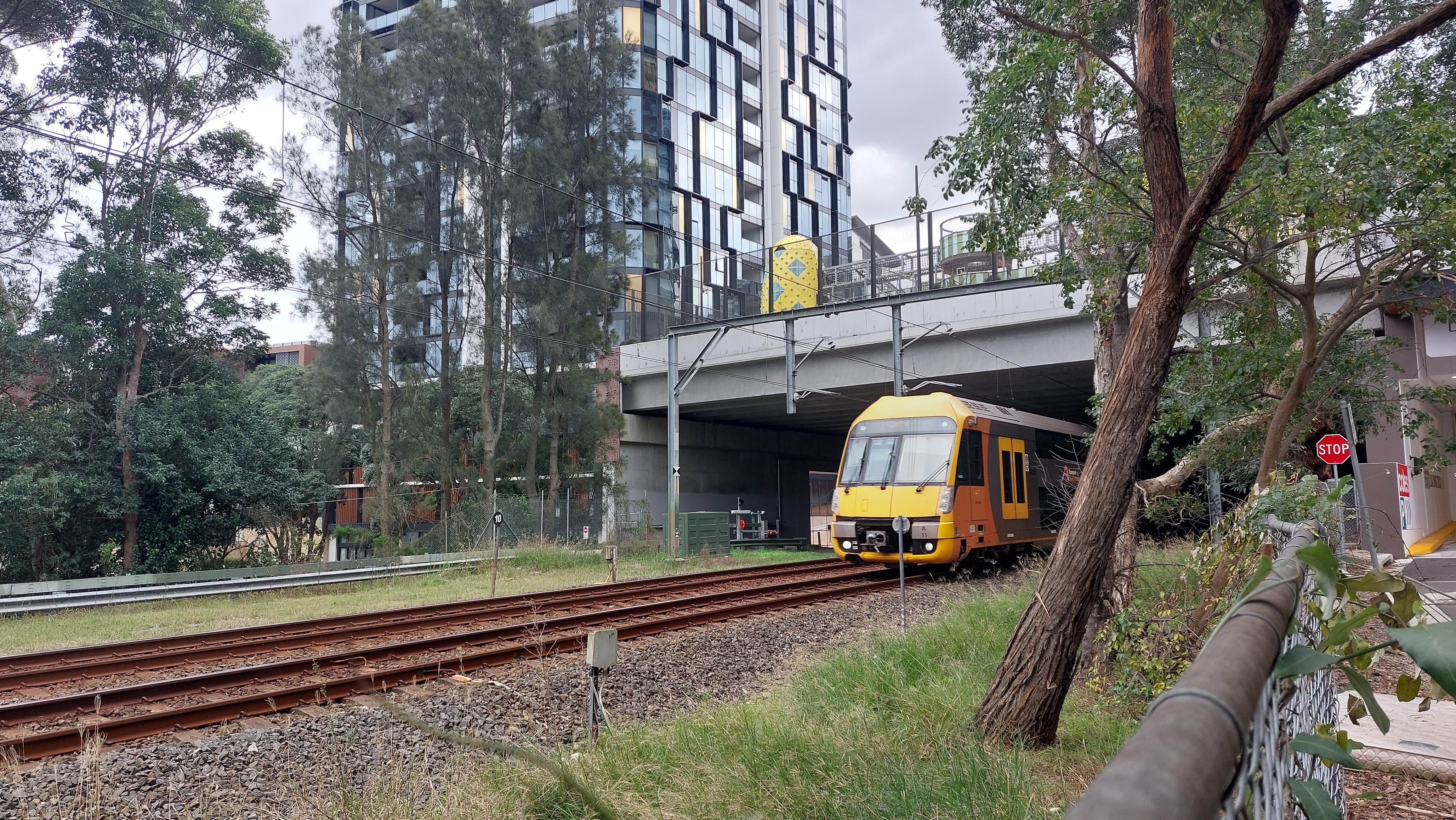
The council is responsible for maintaining the park and all other infrastructure above the deck, but is not responsible for any rail related infrastructure.
According to the council’s research, the park represents an Australian first.
Burwood Council moves
Wadanggari Park has now inspired Burwood Council to consider a similar initiative.
At its April 2024 meeting, Burwood Mayor John Faker moved a mayoral minute which cited Wadanggarri Park – and two other international sites in New York and Singapore – as good examples of re-purposing transport corridors.
“Based on these examples, there are significant opportunities for collaboration between local councils, State Government departments like Transport NSW, and the private sector,” Clr Faker said. “A stronger partnership approach could facilitate the integration of recreational spaces into new and existing infrastructure projects.”
Burwood Council will now write to the NSW Government to highlight the opportunities associated with the delivery of public recreational spaces near transport hubs, including the connecting corridor between Burwood and Croydon railway stations.
It will also:
- Partner with key State Government departments, industry groups and universities to facilitate industry forums in order to identify best practice projects and opportunities to incentivise their delivery in Burwood.
- Pursue opportunities to deliver collaborative projects that integrate recreational spaces with urban development, including the use of rooftops and above-ground spaces for public recreation along the Burwood and Croydon railway corridor.
Other transport corridor projects
If you look closely, work is already underway – or has taken place – to utilise other transport corridors.
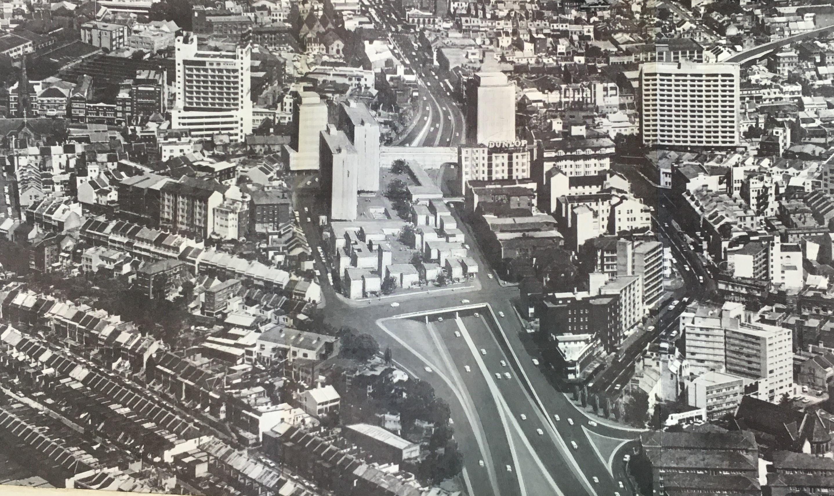
Arguably, Sydney’s Kings Cross Road Tunnel, which opened in 1975, represented the first time a piece of transport infrastructure was specifically designed so that it would support new property development. After a wait of some 20 years, the Elan residential tower was eventually built over the tunnel in the mid-1990s.
In addition, while it has been tarnished by asbestos contamination, the Rozelle interchange is an example of placing infrastructure underground so the surface can be utilised for open space.
The NSW Government is currently considering whether to move ahead with an $11 billion proposal to build around 500,000 new sq/m of building floor space above the railway lines on the southern entrance to Central station.
In total, some 34 buildings are proposed, including for commercial, retail, education, community and cultural, residential, hotel and student accommodation uses. That’s the equivalent of more than 100 football fields of new floor space.
In addition, two hectares of open space will be provided.
This project has a standing objection from the NSW Heritage Council, which has said it will detrimentally impact on the setting of the Sydney Terminal Building and impact the key views from Prince Alfred Park.
Future opportunities
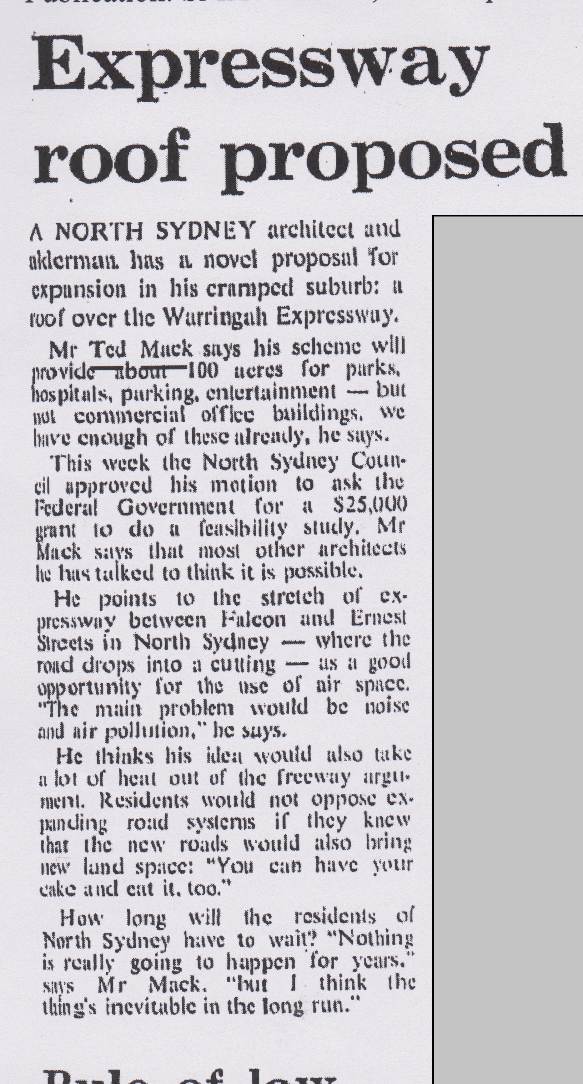
Across Sydney, there are ample other opportunities – think for instance the sunken Warringah Expressway in North Sydney where it is feasible to consider a bridge containing parkland being laid over the roadway.
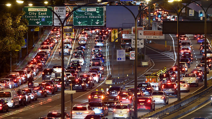
In a major world city like Sydney, creating new open space to service a growing population is an expensive proposition.
Transport corridors – often because they are sunk below ground level – represent an untapped opportunity. What’s more, often the new open space construction can be funded by new development, like in the St Leonards example.
However, to date, the Transit Oriented Development planning reforms proposed by the NSW Government only cover private land, which is missing a potential opportunity on railway land which will have the added benefit of potentially reducing impacts in residential areas.
In 2012, a NSW Parliamentary Inquiry found that “transit oriented development of appropriate sites along and above the rail corridor could benefit the community by generating income for funding future infrastructure projects, facilitating sustainable urban renewal and development, encouraging the use of public transport and reducing car usage and improving the connectivity of local communities.”
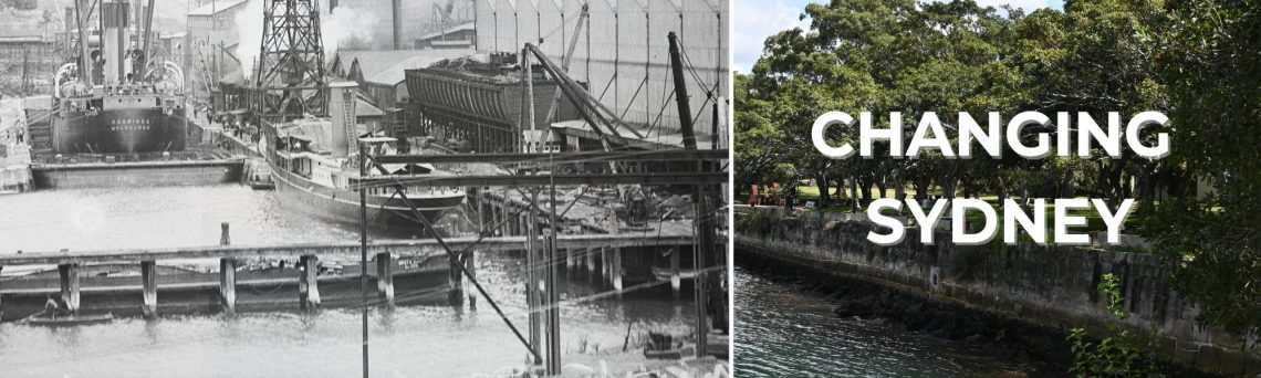
Discover more from Changing Sydney
Subscribe to get the latest posts sent to your email.
