Dulwich Hill will be receiving more planes and aircraft noise as a result of major flight path changes, but due to a disappointing engagement process it’s not clear what the real impact on the suburb will be.
After attending the Inner West engagement event on the flight path changes, and reading closely through the Australian Government’s environmental impact statement, there’s little doubt that more needs to be done to explain the impacts of this proposal.
The environment impact statement (EIS) is attempting to explain changes to flight paths from Sydney Airport as a result of the introduction of Western Sydney International Airport into Sydney’s air space from 2026.
The EIS tries to explain the various current and proposed future flight paths departing Sydney Airport’s main north-south runway.
It states that one such existing flight path involves planes leaving Sydney Airport and flying north over suburbs such as Petersham and Haberfield, before banking right and exiting Sydney over the Northern Beaches. Presumably these are flights leaving to destinations such as New Zealand and the United States.
Under the changes, the EIS says these flights will now take a sharper left turn and fly over Dulwich Hill (and surrounding suburbs including Marrickville and Ashfield) as they head towards what is known as way point NB 010 (located near Parramatta) – see map below.
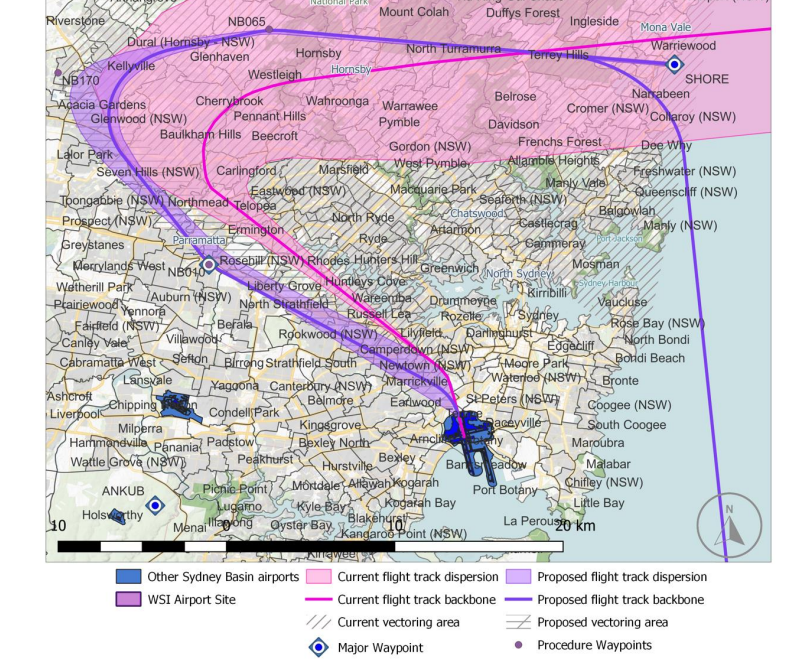
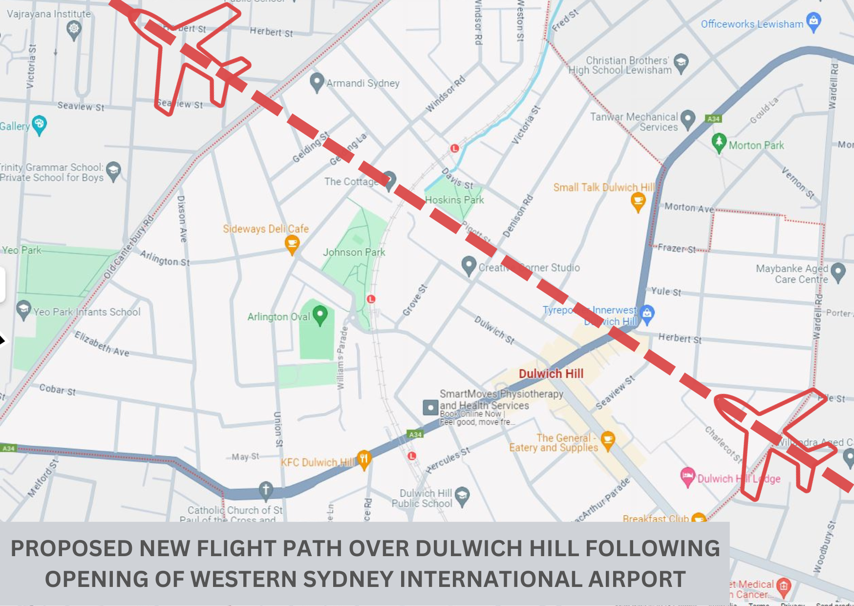
The central ‘backbone’ to this flight path will enter the suburb near the corner of Wardell Rd and Charlecot St and leave around Maddock St and New Canterbury Rd, over-flying places such as the Seaview St carpark and Hoskins Park in the process.
These new planes will join the planes which already over-fly Dulwich Hill, on their way to way point NB 010 and then to domestic and international destinations to the west and south (including Melbourne and South Africa).
Unfortunately, that’s about where the EIS information starts and ends.
This is because the environmental impact statement (EIS), prepared by the Australian Government, reads more like a flight controller’s manual than a resident-friendly analysis of noise and other impacts.
The EIS, for instance, contains no information about localised noise impacts, or a specific figure on the number of additional aircraft which will be flying over the suburb.
The analysis of noise is limited to high-level data about the number of Sydney residents affected by changes to each route.
Clicking on the online ‘noise map’ bears no results for the Inner-West (see below)
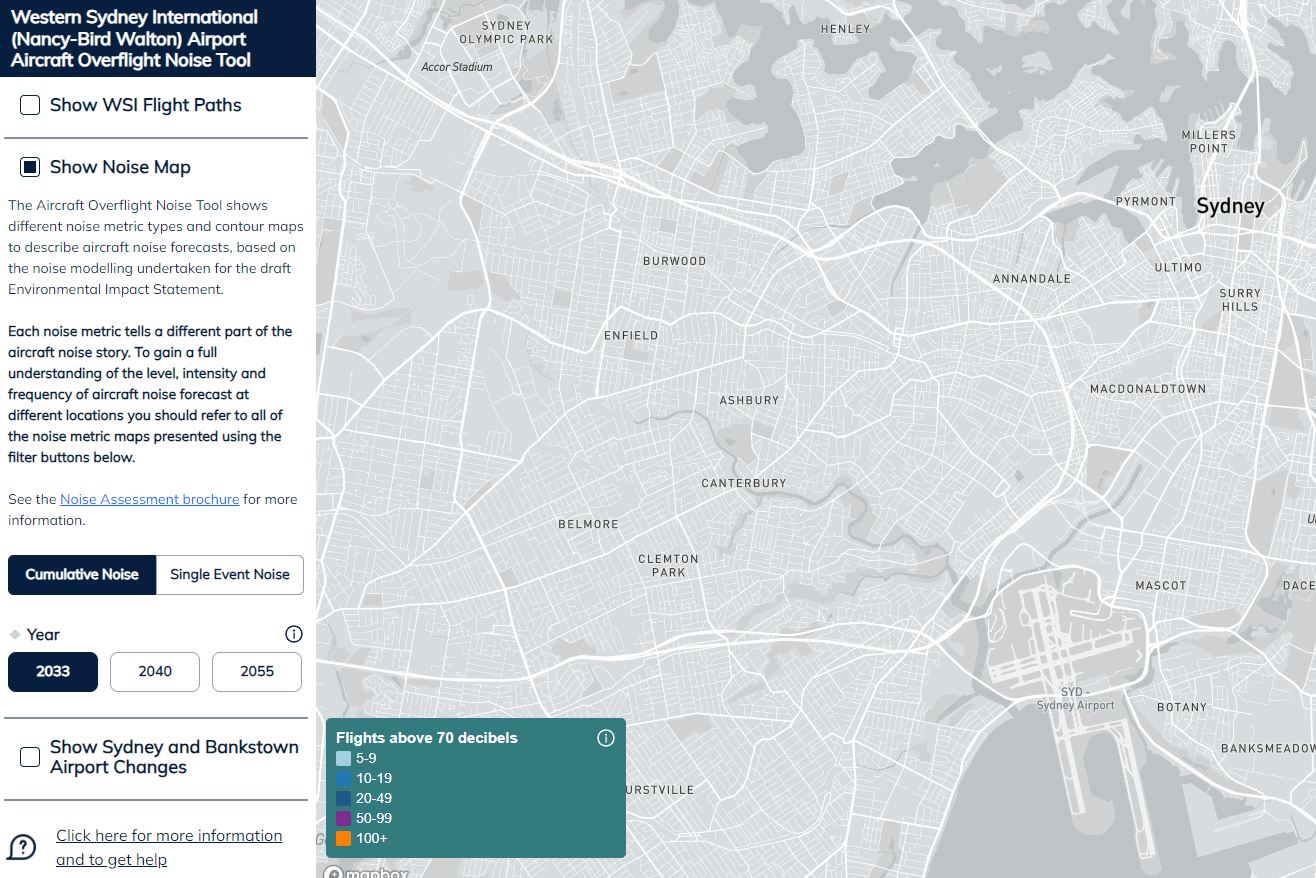
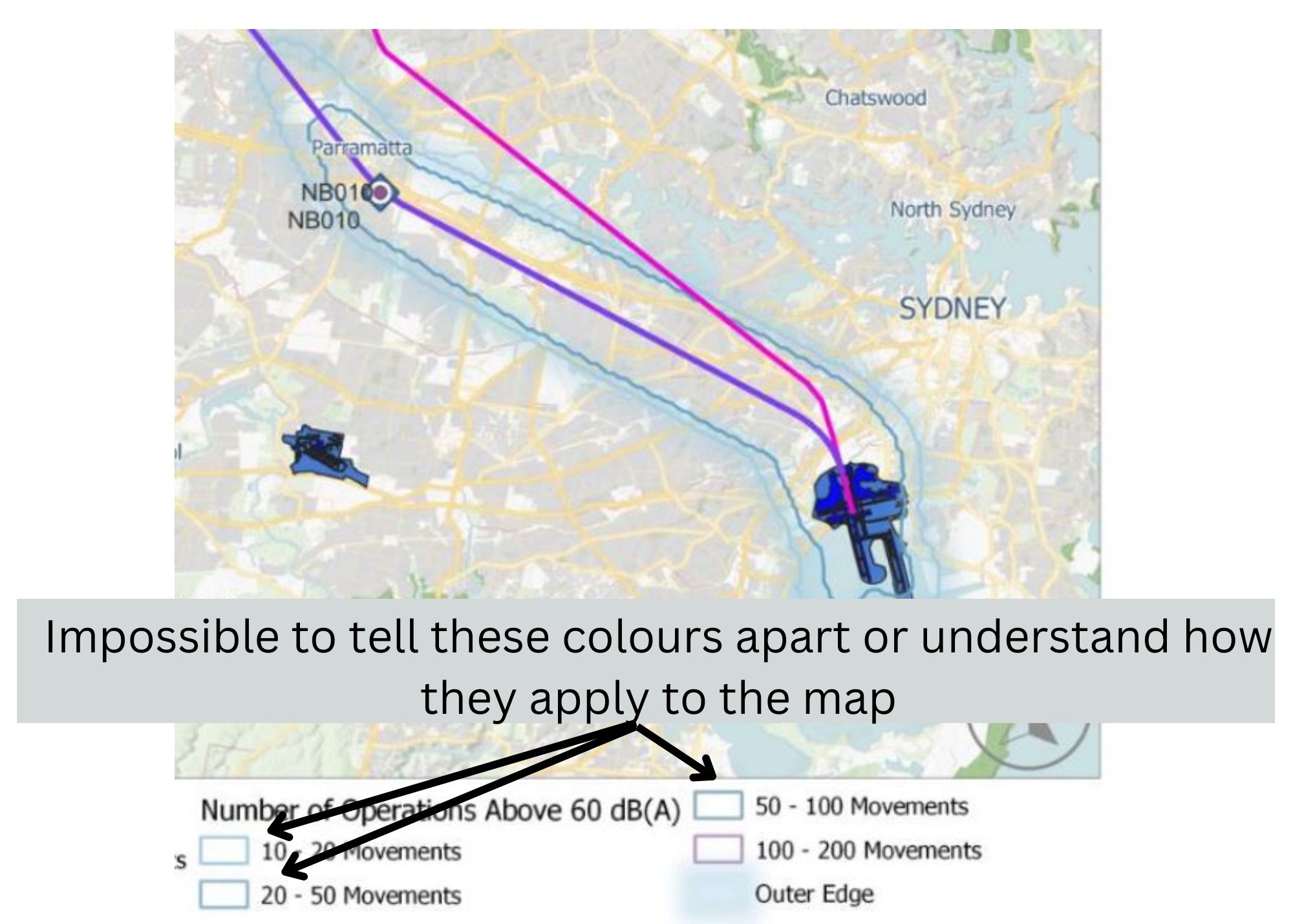
The only map which shows noise impacts has key colours which are impossible to separate and which can’t be applied to the map (see below).
The current preferred way to estimate aircraft is via the Australian Noise Exposure Concept (ANEC).
This tool maps overall noise impacts and is used to determine whether noise is so severe that homes in some streets and suburbs around Sydney Airport should be acquired or provided with noise insulation, and also whether land is suitable for redevelopment for other uses.
However, the EIS fails to include an updated version of this map for Sydney Airport, which means it’s impossible to know whether Dulwich Hill residents and property owners should be eligible for any of these concessions or may be subject to land-use changes.
Questions to staff and consultants at a drop-in session at Sydenham on 22 November yielded no satisfactory answers to any of these questions, or even a clear explanation of why the flight paths need to change when the Western Sydney Airport opens.
Aircraft noise is part and parcel of living in the Inner West.
But that’s not a cover-all excuse for not providing the courtesy of letting people know how they may be impacted by additional aircraft noise, to allow them to respond and make important life decisions, such as selling or buying homes.
This would also apply to other potentially affected suburbs, such as Marrickville, Ashfield, Croydon and Lewisham.
There really is a need for Inner West Council to lobby on this subject, and for our local MP and Prime Minister Anthony Albanese to require better information and consultation.
What’s clear is that, if nothing changes in regard to the current EIS consultation process, any final decision on the EIS in regard to Sydney Airport will have no legitimacy. Comments close on 31 January 2024.
Note on 27 November: Since initially publishing this story, I’ve realised that it’s possible to determine the number of expected future flights above a certain noise level (from 2026) by entering an address at this map. However, this map doesn’t outline the number of existing flights, or changes to noise, and therefore the story above remains accurate.
Discover more from Changing Sydney
Subscribe to get the latest posts sent to your email.

How can l voice my objection to these changes? I believe there is a form which lcan complete. Thank you very much.
Hi there is a link to the submission portal in the story
Thanks Mark for this link. I did find a link & have submitted my objection to the proposed flight path changes. I especially referred to the poor community consultation, lack of information or details regarding the effects of these changes on communities. However the impact on the environment has not been outlined, barely even mentioned. There are huge impacts on the environment, particularly over & on the Blue Mountains Heritage area. Another aspect overlooked, or if so not advised, is that on indigenous cultural heritage. Due to this, I cannot subscribe to these proposed changes.